 Tweet
Tweet
It's been a while since I've posted any trip reports so I decided to gather my pictures from my most recent exploration. My friend Tony was visiting from England over Christmas and we headed out into the desert. We know the name of this mine, but I'm not going to disclose it in this report. PM me if you want to know. I've known of this mine for quite some time but have never taken the time to visit. I don't remember seeing any underground photos so I'm not sure how often it's been explored. There is some evidence of underground exploration but it's not much.
For those of you who know which mine this is, please don't post it in this thread.
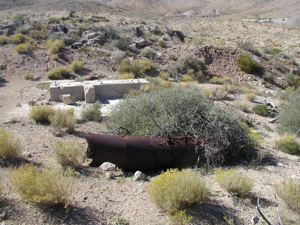
Everywhere we looked there were signs of mining. Equipment foundations were scattered across the area.
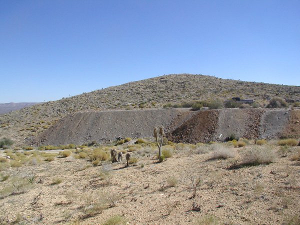
This tailings pile is pretty good sized but small compared to those around it.
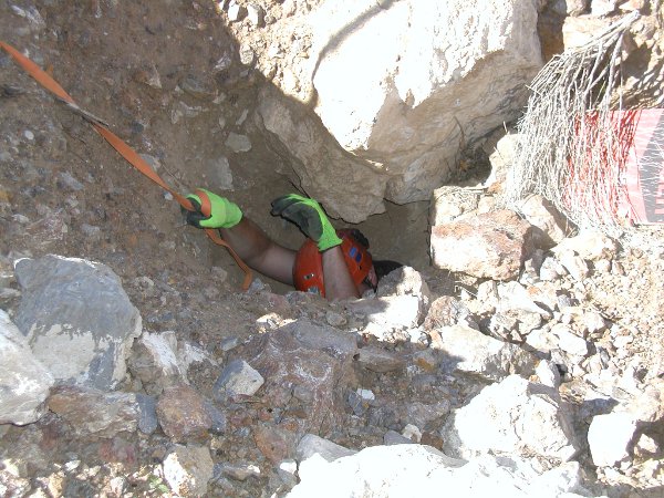
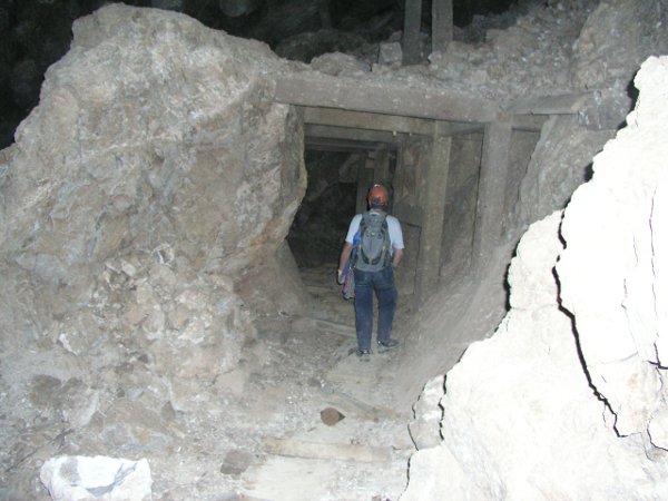
Tony found a small entrance and decided to explore it. Getting in was easy. Out was a bit more work. Unfortunately this lead was blocked.
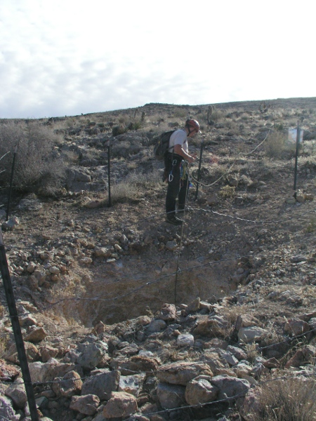
This shaft looked very interesting. Tony dropped it and came to a blockage at about 100 feet. He worked down through the block and descended to about 200 before it was blocked again. It had been a long day so we gave up at that point. We still may go back to see if we can work down through the second blockage.
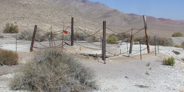
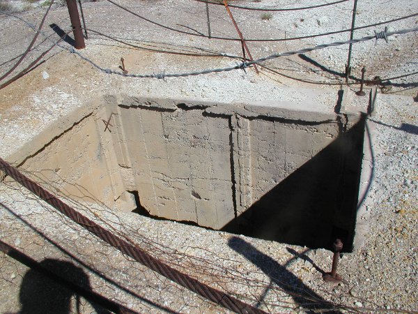
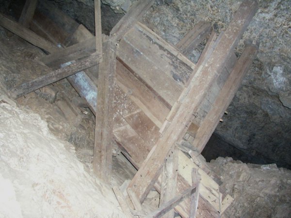
This was a proper collar. Unfortunately all of the shaft lining has collapsed into the shaft.
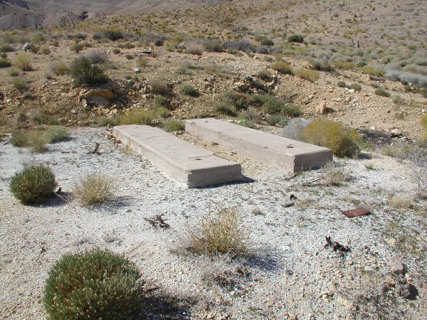
This foundation lined up with the collar and looks like it would have held the winch. The earth around it was quite level and square shaped indicating a building stood here at one time.
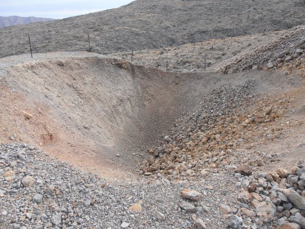
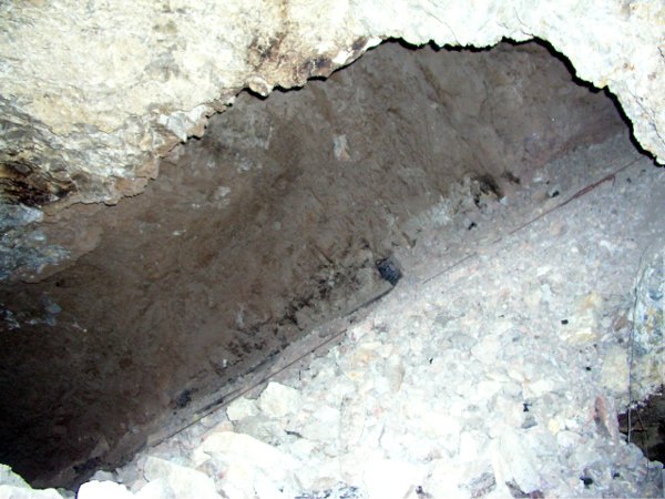
Right in the middle of the tailings pile is the indication of an underground collapse. Upon further research and some underground exploration, it appears that the miners covered over the adit for the main incline.
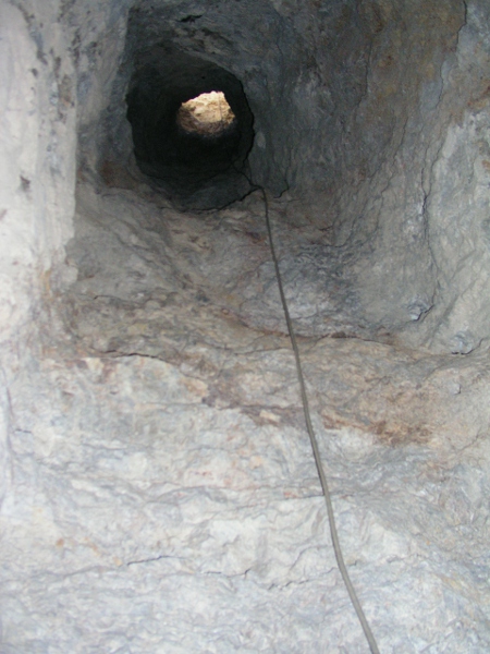
Tony is rigging up to head down. I had dropped this shaft on a previous trip and knew that it lead into the workings.
Looking back up the shaft.
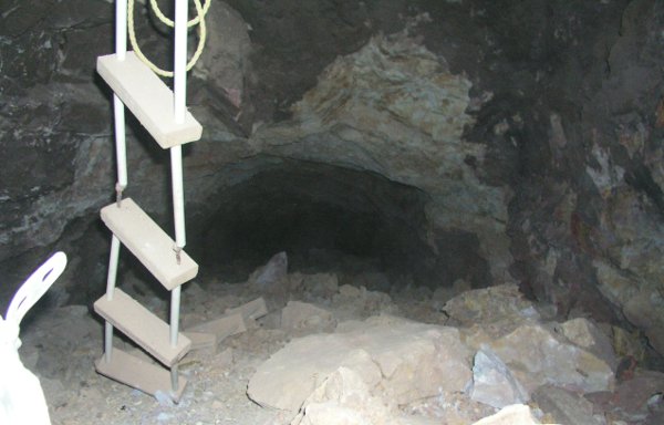
This little ladder leads up into some nice workings. What is not obvious in the picture is that the ladder sits on a bench that has a 30' drop off just off of the picture. Not particularly dangerous unless you lose your footing getting back onto the ladder.
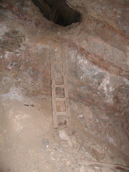
Here is a small ore chute from the same workings. The little ladder is just to the left of the photo.
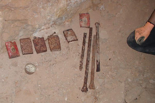
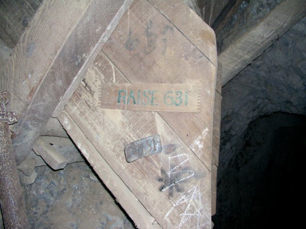
More indication that the mine has not been extensively explored. Most of these items would have been long gone. It's neat to see them in an authentic setting.
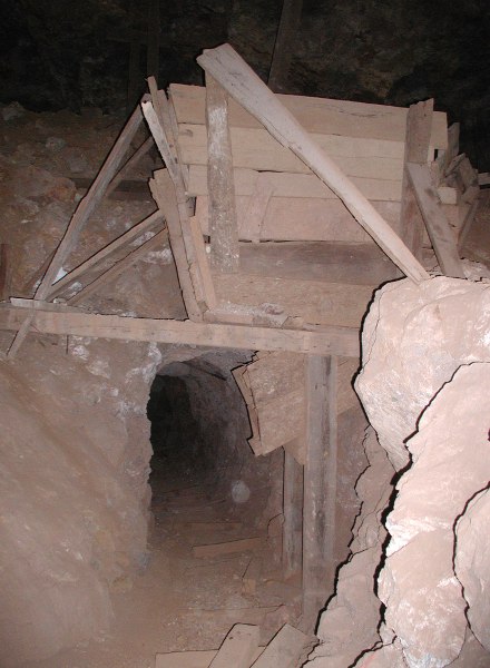
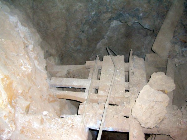
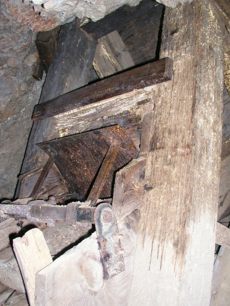
This was an interesting ore hopper above the rails.
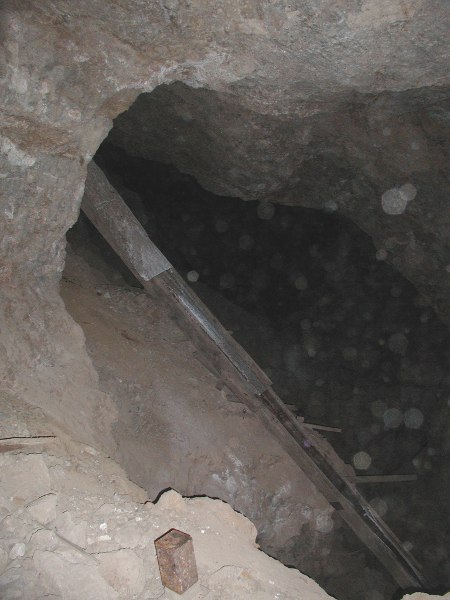
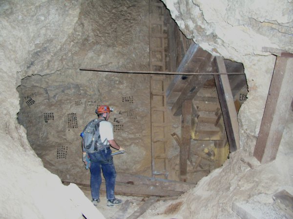
We wanted to find the main incline so we started heading downwards. This is looking back up a manway / ore chute that we descended. It zig-zagged down close to 100' getting us to around the 500 foot level.
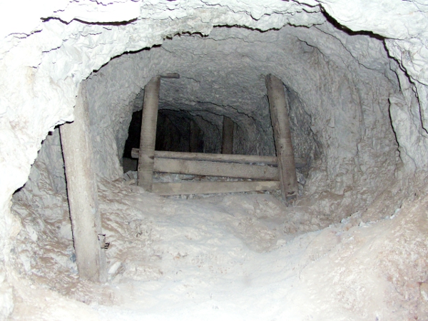
This was evidently an intermediate level because the only access was the manway that we just came down, or up from a lower level via this ore chute. There is about 8' of ladder at the top and 30 feet of drop below that. We rigged a rope and headed down.
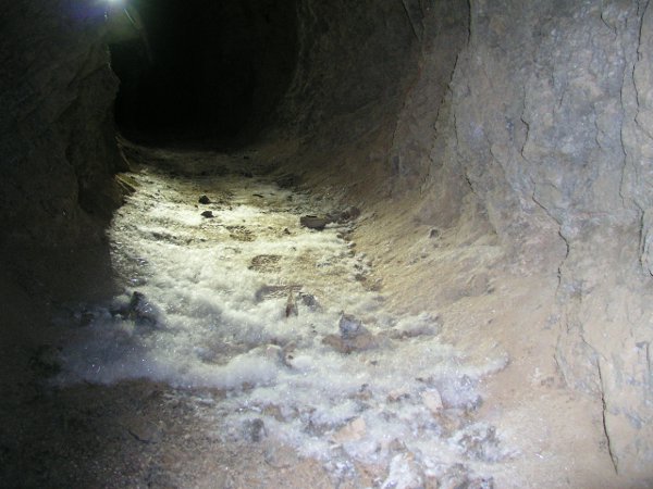
We reached what we though was the 600' level. Down the drift we came across these patches of crystal "angel hair". Don't know what it was, but it was beautiful.
This ore chute confirmed we had found our way to the 600' level. Considering that the deepest level is 1200', we're only half way to the bottom!
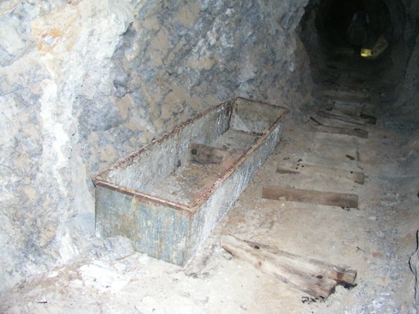
We saw quite a number of metal chute gates in the mine.
As we made our way towards where we thought the main incline should be, the workings became larger and more complex.
The miners obviously pulled a lot of ore out of this chute.
The ore vein sits at close to a 45 degree angle. This stope continued both above and below.
Some great structures in this area. It just felt like we were getting close to the incline. Unfortunately there was a large collapse just in front of Tony.
After climbing over the collapse we had found the incline! We had seen quite a bit of evidence of a fire and the inside of the incline was black with soot. Evidently there has been a serious fire further down.
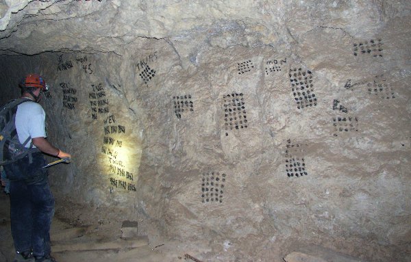
We headed down the incline until we reached the next level, 700'. There are some extensive drifts in the area but no obvious connections to other levels or areas of the mine. There were a couple of small alcoves where the miners had been taking core samples. Holes would lead off at various vertical angles as they searched for more ore.
It had been a long day so we started to head out. We noticed a rope ladder hanging further up the incline where it was blocked by a collapse. We had found a similar ladder near where we rappelled into the mine. Tony climbed up hoping that we would find a shortcut to the surface but no such luck. The ladder lead right into a pile of rock that came from a recent collapse.
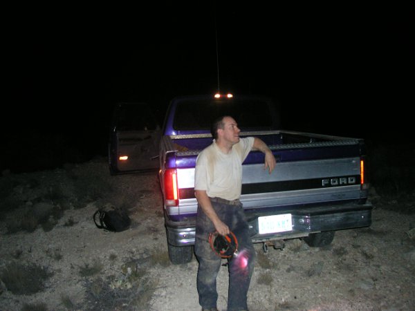
It was a long day and completely dark when we climbed out.
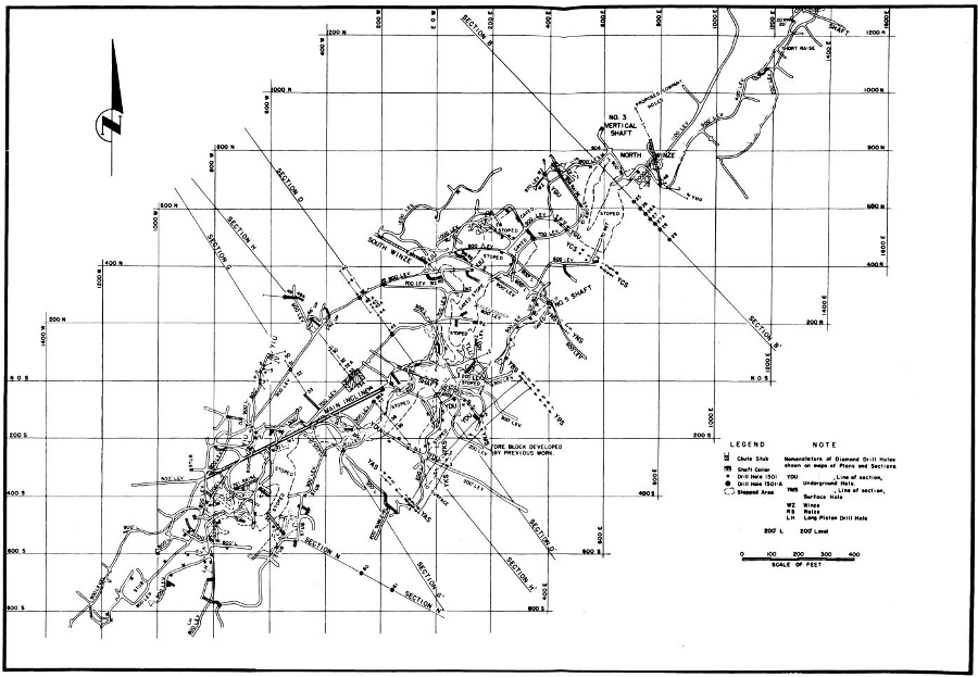
During our research we came across a survey report of this mine, including this map! We were able to scale the map, and Google Earth, so we could overlay the map with the terrain features. Sure enough we could line up all of the openings we had found. It turns out that the mine extends much further that we ever expected. We also found that some of the information commonly found on the internet about this mine is incorrect.
Anyway, it was a great couple of days of exploring. There is a lot more that we would like to do as well. We spent most of our time just trying to find our way to the incline, but didn't spend much poking around all of the drifts.
Joanne
For those of you who know which mine this is, please don't post it in this thread.
Everywhere we looked there were signs of mining. Equipment foundations were scattered across the area.
This tailings pile is pretty good sized but small compared to those around it.
Tony found a small entrance and decided to explore it. Getting in was easy. Out was a bit more work. Unfortunately this lead was blocked.
This shaft looked very interesting. Tony dropped it and came to a blockage at about 100 feet. He worked down through the block and descended to about 200 before it was blocked again. It had been a long day so we gave up at that point. We still may go back to see if we can work down through the second blockage.
This was a proper collar. Unfortunately all of the shaft lining has collapsed into the shaft.
This foundation lined up with the collar and looks like it would have held the winch. The earth around it was quite level and square shaped indicating a building stood here at one time.
Right in the middle of the tailings pile is the indication of an underground collapse. Upon further research and some underground exploration, it appears that the miners covered over the adit for the main incline.
Tony is rigging up to head down. I had dropped this shaft on a previous trip and knew that it lead into the workings.
Looking back up the shaft.
This little ladder leads up into some nice workings. What is not obvious in the picture is that the ladder sits on a bench that has a 30' drop off just off of the picture. Not particularly dangerous unless you lose your footing getting back onto the ladder.
Here is a small ore chute from the same workings. The little ladder is just to the left of the photo.
More indication that the mine has not been extensively explored. Most of these items would have been long gone. It's neat to see them in an authentic setting.
This was an interesting ore hopper above the rails.
We wanted to find the main incline so we started heading downwards. This is looking back up a manway / ore chute that we descended. It zig-zagged down close to 100' getting us to around the 500 foot level.
This was evidently an intermediate level because the only access was the manway that we just came down, or up from a lower level via this ore chute. There is about 8' of ladder at the top and 30 feet of drop below that. We rigged a rope and headed down.
We reached what we though was the 600' level. Down the drift we came across these patches of crystal "angel hair". Don't know what it was, but it was beautiful.
This ore chute confirmed we had found our way to the 600' level. Considering that the deepest level is 1200', we're only half way to the bottom!
We saw quite a number of metal chute gates in the mine.
As we made our way towards where we thought the main incline should be, the workings became larger and more complex.
The miners obviously pulled a lot of ore out of this chute.
The ore vein sits at close to a 45 degree angle. This stope continued both above and below.
Some great structures in this area. It just felt like we were getting close to the incline. Unfortunately there was a large collapse just in front of Tony.
After climbing over the collapse we had found the incline! We had seen quite a bit of evidence of a fire and the inside of the incline was black with soot. Evidently there has been a serious fire further down.
We headed down the incline until we reached the next level, 700'. There are some extensive drifts in the area but no obvious connections to other levels or areas of the mine. There were a couple of small alcoves where the miners had been taking core samples. Holes would lead off at various vertical angles as they searched for more ore.
It had been a long day so we started to head out. We noticed a rope ladder hanging further up the incline where it was blocked by a collapse. We had found a similar ladder near where we rappelled into the mine. Tony climbed up hoping that we would find a shortcut to the surface but no such luck. The ladder lead right into a pile of rock that came from a recent collapse.
It was a long day and completely dark when we climbed out.
During our research we came across a survey report of this mine, including this map! We were able to scale the map, and Google Earth, so we could overlay the map with the terrain features. Sure enough we could line up all of the openings we had found. It turns out that the mine extends much further that we ever expected. We also found that some of the information commonly found on the internet about this mine is incorrect.
Anyway, it was a great couple of days of exploring. There is a lot more that we would like to do as well. We spent most of our time just trying to find our way to the incline, but didn't spend much poking around all of the drifts.
Joanne


Comment