 Tweet
Tweet
I've been itching to get out and do some exploration and today was the day. Unfortunately a dying battery made it so I didn't dare turn off the engine. That severely restricted my exploration activities and sent me home early.  I did get to make some good use of my new 12x50 Nikon binoculars though. I think they are going to be a good tool in helping me to locate and identify mine remnants.
The area south and west of Las Vegas is riddled with old mines. The area that I was exploring today was no different with numerous named mines as well as a large number of adits dotting the sides of the ridges.
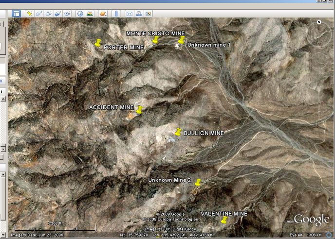
Here's a Google Earth of the area with the mines called out
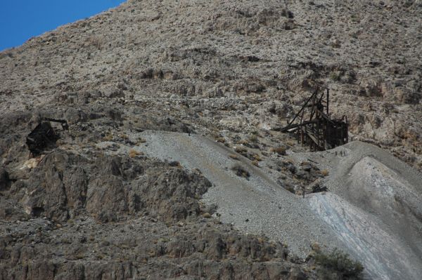
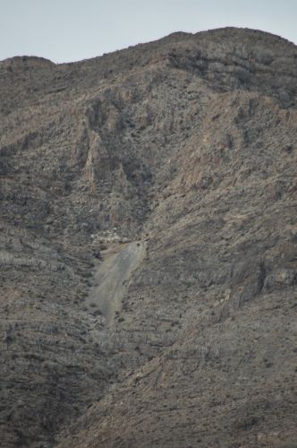
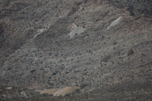
My first stop was at the Bullion Mine. This mine is a few hundred feet up the side of a steep ridge. (They are ALL steep around here!!) At first I didn't understand why there were two structures up at the mine. After a bit of looking I realized that the leftmost structure was the top of a tramway.
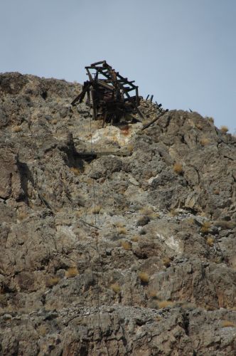
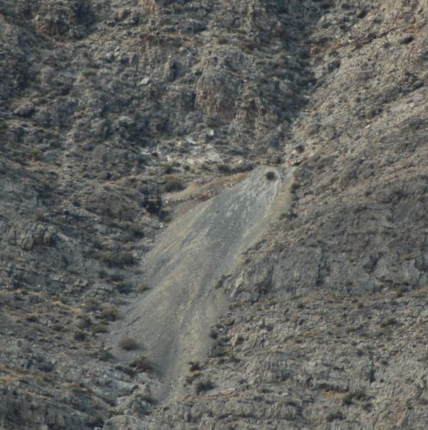
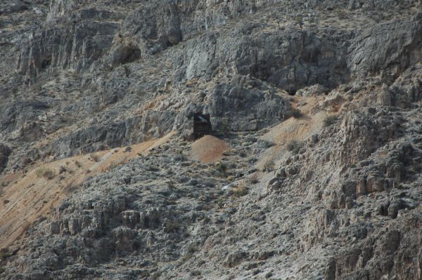
If you look closely you can see one of the tramway cables running down the side of the ridge.
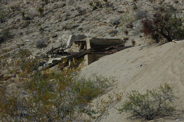
Here's the remains of the lower station. There are a number of foundations around it that indicated that there was some sort of machinery that is long-since gone.
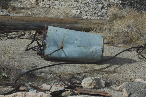
This appears to be a bucket for the tramway. There was another one just a few feet away. Funny though, neither one of them looked as if they had been used. The cable running through the buckets had not worn the holes like you would expect if they had been used to transport ore.
A bit further south was the Valentine mine perched way up on the side of a ridge. Getting up to the adit of this mine is going to be a real hike! It appears that there may have been a tram at this mine as well, but I never got close enough to find the lower station. Next trip maybe....
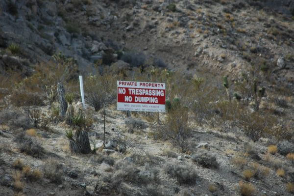
Just over a small ridge was some tailings with three adits well up the side of the ridge. Obviously someone owns or has a claim on the property and doesn't want anyone wandering around. I took a couple of photos and headed back the way I came. (It's shown as Unknown Mine 2 on the Google Earth map)
A bit to the north of the Bullion mine is the Accident mine. It's another site that is going to take some serious hiking to get to.
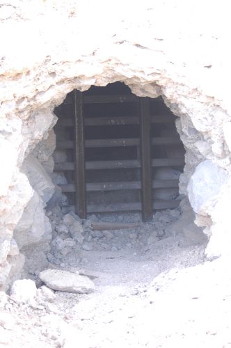
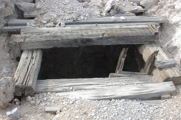
I finally ran into my first "closed" mine. There was an adit that had been blocked as well as a shallow shaft. Looking down the capped shaft showed that it only dropped about 20 feet. From there it looked as if there was a tunnel that went back into the hill. (It's shown as Unknown Mine 1 on the Google Earth map)
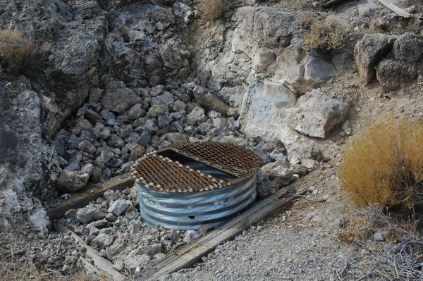
This shaft was just a few feet away from the other two, but had not been closed. The ladder looked like it was in pretty poor shape. I was solo on this trip so I wasn't getting overly adventurous.
In spite of vehicle problems I was able to get the lay of the land in this area. There are quite a few claim markers in evidence though I didn't see any real evidence of anyone actively mining. It's just amazing how many mines are in this area. There is also an area a bit further south and east (around the town of Nipton) that looks very interesting. A person could spend years exploring around in Southern Nevada without having to hit the same mine twice.
Joane
I did get to make some good use of my new 12x50 Nikon binoculars though. I think they are going to be a good tool in helping me to locate and identify mine remnants. The area south and west of Las Vegas is riddled with old mines. The area that I was exploring today was no different with numerous named mines as well as a large number of adits dotting the sides of the ridges.
Here's a Google Earth of the area with the mines called out
My first stop was at the Bullion Mine. This mine is a few hundred feet up the side of a steep ridge. (They are ALL steep around here!!) At first I didn't understand why there were two structures up at the mine. After a bit of looking I realized that the leftmost structure was the top of a tramway.
If you look closely you can see one of the tramway cables running down the side of the ridge.
Here's the remains of the lower station. There are a number of foundations around it that indicated that there was some sort of machinery that is long-since gone.
This appears to be a bucket for the tramway. There was another one just a few feet away. Funny though, neither one of them looked as if they had been used. The cable running through the buckets had not worn the holes like you would expect if they had been used to transport ore.
A bit further south was the Valentine mine perched way up on the side of a ridge. Getting up to the adit of this mine is going to be a real hike! It appears that there may have been a tram at this mine as well, but I never got close enough to find the lower station. Next trip maybe....
Just over a small ridge was some tailings with three adits well up the side of the ridge. Obviously someone owns or has a claim on the property and doesn't want anyone wandering around. I took a couple of photos and headed back the way I came. (It's shown as Unknown Mine 2 on the Google Earth map)
A bit to the north of the Bullion mine is the Accident mine. It's another site that is going to take some serious hiking to get to.
I finally ran into my first "closed" mine. There was an adit that had been blocked as well as a shallow shaft. Looking down the capped shaft showed that it only dropped about 20 feet. From there it looked as if there was a tunnel that went back into the hill. (It's shown as Unknown Mine 1 on the Google Earth map)
This shaft was just a few feet away from the other two, but had not been closed. The ladder looked like it was in pretty poor shape. I was solo on this trip so I wasn't getting overly adventurous.
In spite of vehicle problems I was able to get the lay of the land in this area. There are quite a few claim markers in evidence though I didn't see any real evidence of anyone actively mining. It's just amazing how many mines are in this area. There is also an area a bit further south and east (around the town of Nipton) that looks very interesting. A person could spend years exploring around in Southern Nevada without having to hit the same mine twice.
Joane


 There's not a lot of us around. A few years ago I decided to undertake a really big project of building my own camping trailer. It turned out pretty good and I love camping in it.
Comment